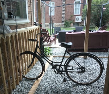
観光スポット
Meyersdale, PA, 15552
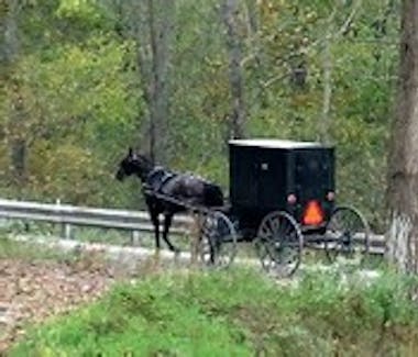
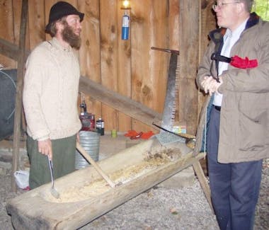
Amish Countryside
Visit the many Amish owned shops and businesses in and around Meyersdale. From farm fresh produce and baked goods to hand-crafted treasures, take home a piece of the Amish countryside.
Ask a staff member for some information, list of local Amish owned businesses, and to add some traditional Amish items to your breakfast menu.
The Amish of Somerset County, PA (25 Photos) - Amish America
Meyersdale, PA, 15552
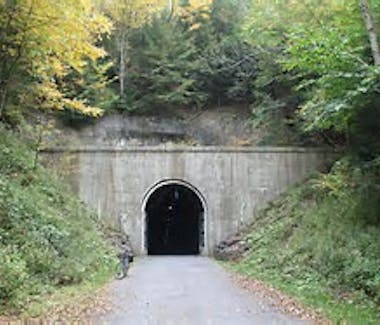
Big Savage Tunnel
12.2 miles
The Big Savage Tunnel is a formerly abandoned railway tunnel located southeast of Meyersdale, Pennsylvania. The Big Savage Tunnel is part of the Great Allegheny Passage. It was originally built for the Connellsville subdivision of the Western Maryland Railroad. It is the longest tunnel on the Great Allegheny Passage.
Mason Dixon Highway Garrett, PA 15542
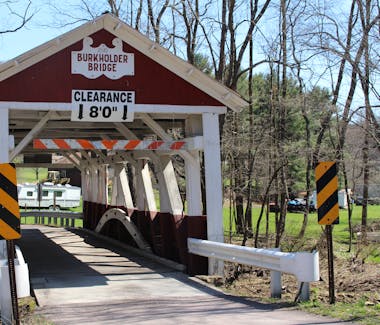
Burkholder Covered Bridge
6.6 miles
Burkholder Covered Bridge was built in 1870 crossing Buffalo Creek in Brothers Valley Township. The structure is 52' long, 12' wide and over 8 ' high. The bridge is open to vehicle traffic.
Ask a staff member for information about touring the many covered bridges in Somerset County.
Visiting the 10 Historic Covered Bridges in Somerset County, PA - Uncovering PA
301 High Street, Meyersdale, PA,15552
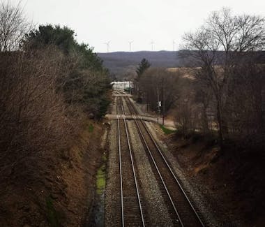
CSX Railway
Perfect for Train Watchers, Red Lantern Bed & Breakfast is located beside an active CSX railway. Watch from a comfy seat in the back yard or the railroad bridge adjacent to the property.
CSX rail, intermodal and rail-to-truck transload services - CSX.com


Somerset County, PA, USA
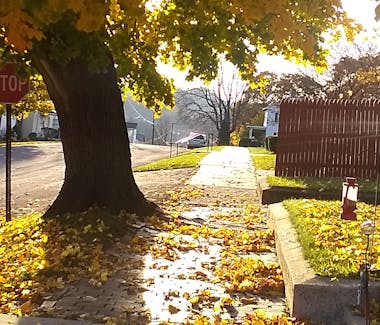
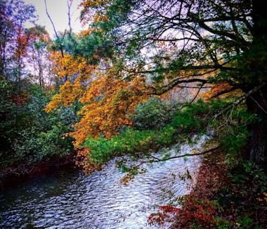
Fall Foliage
Don't miss out on the beauty of Autumn in the Laurel Highlands. One of only three deciduous forests in the world, that display Fall colors.
When Fall colors are in the air, check the link below for Peak Season Updates.
1491 Mill Run Road, Mill Run, PA, USA
Fallingwater
Fallingwater is a house designed in 1935 by renowned American architect Frank Lloyd Wright (1867-1959) for the Kaufmann family, owners of Pittsburgh’s largest department store. Frank Lloyd Wright's Fallingwater is one of his most widely acclaimed works and best exemplifies his philosophy of organic architecture: the harmonious union of art and nature.
Fallingwater is located in the mountains of Southwestern Pennsylvania, also known as the Laurel Highlands, in Mill Run, Fayette County, which is about 70 miles southeast of Pittsburgh. Wright designed Fallingwater to rise above the waterfall over which it is built. Local craftsmen quarried native sandstone and other materials from the property and completed the construction of the main house, guest house and service wing in 1939.
taken from www.fallingwater.org

Somerset County, PA, USA
Farmer's Markets
Farmer's Markets can be found all around Somerset County and on varying days of the week.
Take cash, as some venders will be cash only.
Most markets have seasonal hours.
Links may not be available in the off season.
Maple City Farmers Market | Meyersdale PA | Facebook
SoCo Farmers' Market | Somerset PA | Facebook
New Centerville Farmer's Market | Facebook
https://www.facebook.com/people/Rockwood-Farmers-Market/100091542250260/
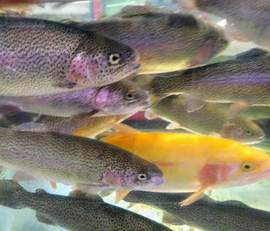
www.golaurelhighlands.com/outdoors/activities/fishing/
Fishing
Click on the link below, to connect to some of the best fishing spots Pennsylvania has to offer.
We even have a fish cleaning table, and coolers for your big catch!
www.golaurelhighlands.com/outdoors/activities/fishing/
Fishing license required in Pennsylvania.
One day licenses are available.
How Much Is a Fishing License in Pennsylvania? (Regulations and More) - Guide Recommended
6424 Lincoln Highway, Stoystown, PA 15560
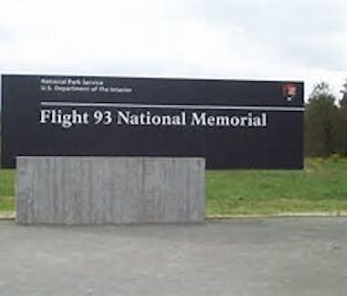
Flight 93 Memorial
29.5 miles
814-893-6322
Flight 93 National Memorial (U.S. National Park Service)
The National Memorial honors Flight 93's passengers and crew for their courageous actions on September 11, 2001.
Meyersdale, PA 15552
Great Allegheny Passage
Running through the Trail Town of Meyersdale, PA, the GAP trail is a nearly level, 150-mile route, which winds through the picturesque Laurel Highlands; connecting with the C&O Canal Towpath in Cumberland, MD, creating a 334.5-mile trail from Pittsburgh, PA, to Washington, DC.
Check the link above, for up-to-date Trail information and closures.

Somerset County, PA, USA
Golf the Laurel Highlands
Check out all the awesome golf courses and packages they offer, in the beautiful Laurel Highlands.

Great American Rail Trail
Great American Rail Trail
The Great American Rail-Trail is the nation’s first cross-country multiuse trail, stretching more than 3,700 miles between Washington, D.C., and Washington State. This trail is an iconic piece of American infrastructure that will connect thousands of miles of rail-trails and other multiuse trails, serving tens of millions of people living along the route as well as those who visit the trail from around the country and the world.
from Great American Rail-Trail - Rails to Trails Conservancy | Rails to Trails Conservancy
Travel the Great American Rail Trail, passing along the Great Allegheny Passage, 0.4 miles from Red Lantern Bed & Breakfast.
126 Woodland Road, Rockwood, PA, USA
Haunted Hollow
10.5 miles
Welcome to Haunted Hollow. Western Pennsylvania's Premier Haunted Attraction. Located off the PA Turnpike near Somerset, PA.
For hours and all of the details, see the website.
Hours are seasonal.
1 Craighead Road, Hidden Valley, PA, 15502
Hidden Valley Resort
25.8 miles
814-443-8000
An all season, family resort includes golfing, skiing, Spa, indoor pool, and many events throughout the year.
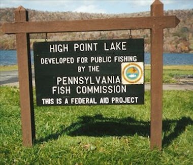
High Point Lake, Pennsylvania, USA
High Point Lake
13.4 miles
Located a short drive from Red Lantern B&B, near Mt. Davis, the highest point in PA, High Point Lake is a 338 acre impoundment owned by the Commonwealth of Pennsylvania and managed by the Fish and Boat Commission. High Point Lake provides great fishing for Large and Smallmouth Bass, Walleye, Northern Pike, Yellow Perch, Black Crappie, Bluegill, and Bullhead. Boating at the lake is limited to electric and un-powered boats; two launch ramps are available as well as parking facilities. Fishing tournaments are hosted annually.
from https://www.pa.gov/agencies/fishandboat/about-us/pfbc-lakes/high-point-lake

Somerset County, PA, USA
Kayaking & Boating
There are lots of beautiful spots to kayak and boat in the Laurel Highlands, just miles from Red Lantern B&B.
Bring your own with you or rent what you need, places like Somerset Lake, High Point Lake, Laurel Hill State Park and local rivers, lakes, and creeks are all relaxing scenic choices.
Contact us today to get more info or form help planning a trip.
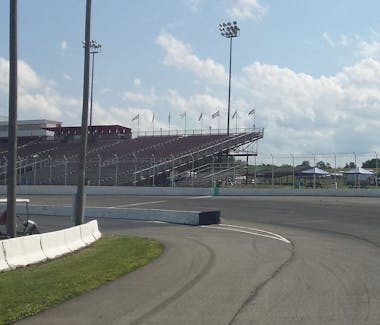
206 Somerset Street, Jennerstown, PA 15547
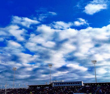
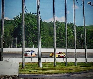
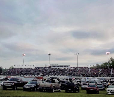
Jennerstown Speedway Complex
29 miles
814-703-8009
Experience the thunder in the mountains and the thrill of Saturday night races at the Jennerstown Speedway. You may even see the Red Lantern B&B #8 car on the track along with a few other Red Lantern sponsored cars.
2026 brings the addition of live music events to The Big J!
124 Main St. Ohiopyle, PA 15470
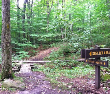
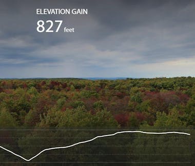
Laurel Highlands Hiking Trial
Laurel Highlands Hiking Trail
The 70-mile hiking trail stretches along Laurel Mountain from the picturesque Youghiogheny River at Ohiopyle State Park to the Conemaugh Gorge near Johnstown. Seasoned backpackers challenge themselves on the steep, rugged areas of the trails. Casual hikers enjoy areas that are reasonably level and pleasant for walking.
The trail is the main feature of Laurel Ridge State Park. It traverses state parks, state forests, state game lands, other public lands, and private lands. The Laurel Highlands Hiking Trail is a major segment of the Potomac Heritage National Scenic Trail, a network of trails between the mouth of the Potomac River and the Allegheny Highlands.
from https://www.pa.gov/agencies/dcnr/recreation/what-to-do/hiking/laurel-highlands-hiking-trailhttp://www.pa.gov/agencies/dcnr/recreation/what-to-do/hiking/laurel-highlands-hiking-trail
527 Main Street
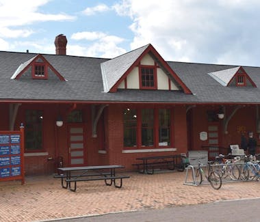
Meyersdale Historical Society
0.5 miles
814-634-8654
Mid-April through the last weekend in October
Daily 9AM- 4:30PM
This restored Western Maryland Railway station houses a Visitors Center at the trail head to the Great Allegheny Passage, along with exhibits relating to the area's history, a model train display, rest area, gift shop and programs highlighting the trail and local events and activities.
210 Center Street Meyersdale, PA 15552
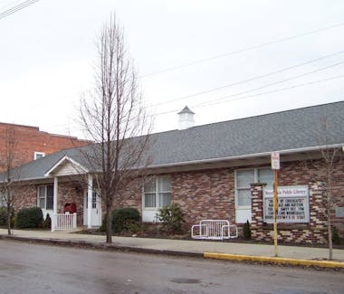
Meyersdale Public Library
0.2 miles
814-634-0512
M-F 10 AM-7PM
Sat 10 AM-5PM
Meyersdale Public Library was established in1939, by the local Women's Club. The library offers many programs and events through out the year, along with a huge Local and Genealogy collection.
Meyersdale, PA, 15552
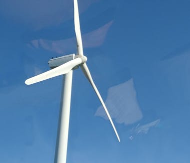
Meyersdale Windfarm
The Meyersdale Wind Farm is a wind farm located in Meyersdale, Somerset County, Pennsylvania with 20 NEG Micon/Vestas 1.5 MW wind turbines that began commercial operation in December 2003. The wind farm has a combined total nameplate capacity of 30 MW, enough to power about 10,000 homes.
https://www.gridinfo.com/plant/meyersdale-windpower-llc/56052
Mt Davis, Elk Lick Township, PA, USA
Mt. Davis Pennsylvania High Point Trail
9.3 miles
5.4 miles long, this trail is located along the highest point in Pennsylvania.
Mount Davis Pennsylvania Highpoint Trail, Pennsylvania - 860 Reviews, Map | AllTrails
Somerset County, PA, USA
Pennsylvania Flora & Fauna Bird, wildlife, and botanical toursim
Stay tuned. Page under construction.
120 Meyers Avenue Meyersdale, PA 15552
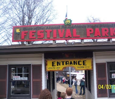
Pennsylvania Maple Festival
0.4 miles
Maple Festival Office- PO Box 222, Meyersdale, PA, 15552
814-634-0213
2nd and 3rd weekends in March
The Pennsylvania Maple Festival is an annual festival in Maple City, Meyersdale, PA, to celebrate the coming of Spring, the tapping of the maple trees to produce maple syrup, and the wonder and beauty of the Laurel Highlands. Many events are planned every year, such as the pancake breakfasts, various vehicle and car shows, quilt show, theater productions, live music, craft and vender shows, and parade.
140 Haupt Road, Somerset, PA, 15501
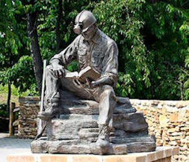
Quecreek Mine Rescue Foundation
21.1 miles
814-445-5090
Rescue Site- 8 AM- 8 PM Daily
The Quecreek Mine Rescue Foundation honors the team of rescue workers and the nine trapped coal miners saved from certain death. The Monument for Life displays artifacts from the rescue, houses a Visitors Center and a park.
Meyersdale,PA, 15552
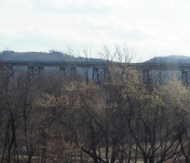
Sailsbury Viaduct
1.5 miles
The Salisbury Viaduct is a railroad bridge in Meyersdale, PA, built in 1912, now used as part of the Great Allegheny Passage. The bridge was decommissioned in 1975 and converted for biking and hiking in 1998
.https://gaptrail.org/amenities/salisbury-viaduct/
Flight 93 National Memorial, Lincoln Highway, Stoystown, PA, USA
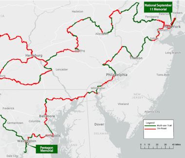
The September 11th National Memorial Trail
The September 11th National Memorial Trail is a 1,300 mile multi-use route that links the World Trade Center, the Pentagon, and the Flight 93 Memorial. Join us on The Trail and embrace the commemorative history of September 11, 2001... remember, discover, and connect.
from www.911trail.org
777 Waterwheel Drive, Seven Springs, PA, 15622
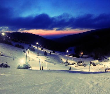
Seven Springs Mountain Resort
23.9 miles
800-452-2223
An all season, family resort, home to skiing, mountain biking, golf, swimming, rental units, as well as a myriad of festivals and events, such as Mud on the Mountain, Fall festivals,, and Winefest.
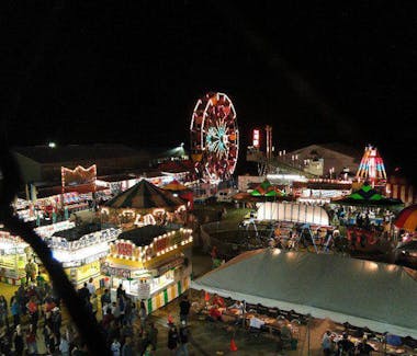
7842 Mt. Davis Rd, Meyersdale, PA 15552
Someset County Fair Grounds
http://somersetcountyfairpa.com
Somerset County Fair -End of August (Dates change year to year.)
Home of the Somerset County Fair along with other annual events.


Lake Somerset, Somerset Township, PA, USA
Somerset Lake
18.3 miles
Located in Somerset County, Lake Somerset is a 253-acre impoundment owned by the Commonwealth of Pennsylvania and managed by the Fish and Boat Commission for public fishing and boating. The Commission's Southwest Region Office (Law Enforcement, Fisheries Management, Education, Maintenance) is located at the lake.
from
Lake Somerset | Fish and Boat Commission | Commonwealth of Pennsylvania
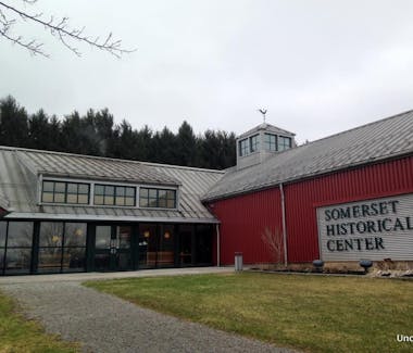
10649 Somerset Pike, Somerset, PA, USA
Somerset Historical Society
20 miles
814-445-6077
www.somersethistoricalcenter.org
A 150-acre rural history museum, located in Somerset, PA. Also, the headquarters of the Somerset Genealogical Society of Somerset County. Check website for annual events and happenings.
Somerset County, PA, USA
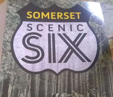
Somerset Scenic 6 Motorcycle Rides
www.golaurelhighlands.com/plan/motorcycle-routes/
Take a motorcycle ride on one of these great trips.
Flight 93 Loop
Coal Heritage Loop
Mt. Davis Loop
Pike and Ridge Loop
Mason Dixon Loop

1711 Spring Road Springs, PA 15562
Springs Museum/Farmer's Market/Folk Fest
11.6 miles
Museum hours- Wed-Fri 1 PM-5 PM, Sat 9 AM-2 PM
Farmer's Market- Saturdays, May 27- Sept. 23, 8 AM-1 PM
Folk Fest- Oct 6-7, 9 AM-5 PM
814-442-4994
Somerset County, PA, USA